Recently viewed items:

The Countess of Shaftesbury
England. Original steel engraving, engraved by E. Finden after J. Hayter. 1867. Very good condition. Decorative border. Hand-coloured. 23x18,5cm. Matted.
Sold
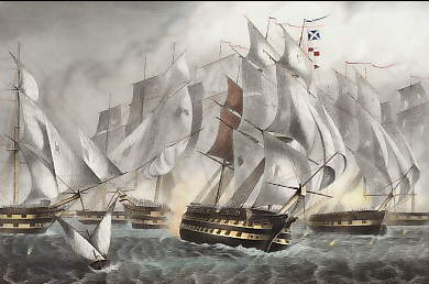
Sir C. Napier´s Victory Off Cape St Vincent
Portugal. Original steel engraving, engraved by D. J. Pound after G. W. Terry. 1851. Very good condition. Decorative border. Hand-coloured. 17x11,5cm. Matted.
Sold
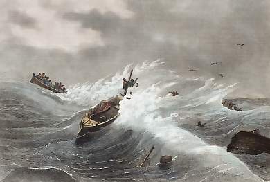
Naufrage De 78 Pêcheurs De La Teste
Maritime. Original steel engraving drawn by L. Bourgade, engraved by Ransonnette. 1837. Very good condition. Hand-coloured. 22x15cm. Mounted.
 +49 40 4204212

