Recently viewed items:
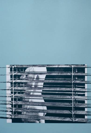
(Weiblicher Akt hinter der Jalousie)
Germany. Original screen print by Jens-Michael Barge (1940-). 1970. n°136/250. Numbered and signed in pencil. Very good condition. 53x36cm. DHL shipping only.
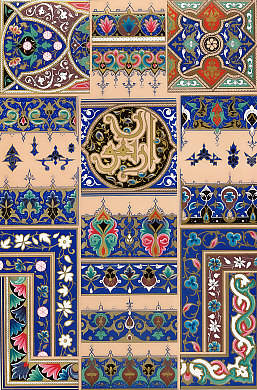
Arabe
Arabia. Original chromolithohraph, engraved by Dufour and Durin after Albert Charles Auguste Racinet. 1885. Very good condition. 29x19,5cm. Matted.
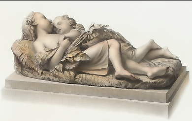
The Children in the Wood
Varia. Original steel engraving, engraved by W. Roffe after F. R. Roffe (sculpture by J. Bell). 1853. Very good condition. Hand-coloured. 25,5x13cm. Matted.
Sold
 +49 40 4204212

